
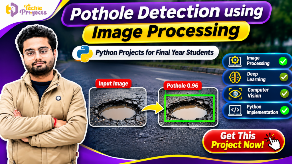
🚀 Looking for a practical Python project based on Artificial Intelligence, Deep Learning and Computer Vision? Get the Pothole Detection Using Image Processing project from Techie Projects! This project is designed for engineering students who want to explore how computer vision techniques can be applied to identify road potholes from images or video frames.
Instead of spending weeks building a project from scratch, you can enquire about our ready project package and get assistance with the available source code, project documentation, implementation details and demonstration. Whether you are preparing a final-year engineering project, college submission or technical presentation, this project offers an interesting opportunity to understand real-world image processing applications.
The Pothole Detection Using Image Processing project focuses on identifying damaged road surfaces through image analysis and computer vision techniques. It demonstrates how Python-based technologies can help process road images and highlight possible pothole regions.
🎓 Get this project from Techie Projects and make your final-year project journey easier!
📞 Contact Techie Projects for Project Enquiries
Want to purchase this project or know more about the available package?
- WhatsApp: https://wa.me/919460060699
- Contact Number: +91 94600 60699
- Website: https://techieprojects.com/
- Instagram: https://www.instagram.com/pythonprojects_/
Contact us to confirm the source code, documentation, software requirements, demonstration and available technical support before purchasing.
🎬 Watch the Pothole Detection Using Image Processing Project Demo
Explore the project demonstration to understand its concept, interface and pothole identification workflow.
The demonstration can help students understand how road images are processed and how possible pothole regions can be highlighted through computer vision techniques.
🔍 What Is Pothole Detection Using Image Processing?
Pothole detection is a computer vision application that identifies damaged portions of road surfaces. Potholes are common road defects that can affect vehicle movement, driving comfort and road safety.
Traditional road inspection often requires people to manually observe road conditions and report damaged locations. Image processing and machine learning provide another approach by analysing digital images and identifying visual patterns associated with road damage.
The Pothole Detection Using Image Processing project demonstrates how a Python application can analyse road images and identify potential pothole regions.
Depending on the implementation, the system may use image processing operations, a trained machine learning model or a deep learning object detection model to identify potholes.
The main objective is to demonstrate an automated visual inspection approach using programming and computer vision.
🎯 Objectives of the Project
The major objectives of this project include:
- To understand road damage identification using computer vision.
- To process road images using Python.
- To identify possible pothole regions in input images.
- To explore image processing and deep learning concepts.
- To understand how object detection models can be applied to road inspection.
- To develop practical programming knowledge.
- To demonstrate an AI-based approach to a real-world engineering problem.
This project is particularly useful for students interested in Artificial Intelligence, Machine Learning, Image Processing and Python development.
⚙️ How Does the Pothole Detection System Work?
The project follows a computer vision workflow in which road images are provided as input and analysed to identify possible damaged areas.
The exact workflow depends on the selected implementation and model.
1. 📷 Input Image Collection
The first step involves collecting road images containing normal road surfaces and potholes.
Images can be obtained from available datasets or captured using a camera. A suitable dataset helps the model learn visual characteristics associated with road damage.
2. 🖼️ Image Preprocessing
Image preprocessing prepares input images for further analysis.
Common operations may include:
- Image resizing
- Noise reduction
- Image enhancement
- Colour conversion
- Normalisation
These operations help maintain consistent image dimensions and prepare the input for subsequent processing.
3. 🧠 Model Training and Detection
A machine learning or deep learning model can be used to identify pothole patterns.
For example, an object detection model can learn to locate potholes and generate bounding boxes around detected regions.
The model’s performance depends on the training dataset, image quality, model configuration and testing conditions.
4. 🟩 Pothole Identification
After processing the image, the system can display detected pothole regions.
Depending on the implementation, the output may include:
- Highlighted pothole regions
- Bounding boxes
- Class labels
- Confidence scores
- Processed output images
5. 📊 Output Display
The final stage displays the processed image and detection results through the application’s available interface.
This allows users to understand how the system analyses road images.
💻 Technologies Used in Pothole Detection Using Image Processing
Python is commonly used for computer vision and machine learning development because it provides access to several useful libraries and frameworks.
The technologies below are relevant to this project. The exact packages included depend on the supplied implementation.
🐍 Python
Python is the primary programming language used to develop the application. Its libraries support image processing, model development and application integration.
📸 OpenCV
OpenCV is a popular computer vision library used for image reading, resizing, colour conversion, filtering and other image processing operations.
🔥 Deep Learning
Deep learning models can learn visual patterns from road images and help identify possible pothole regions.
🎯 YOLO Object Detection
YOLO is an object detection approach that can locate objects within images and generate bounding boxes. A suitable trained model can be used for pothole identification.
📊 NumPy
NumPy supports numerical operations and array processing, which are frequently required in image processing applications.
🖥️ User Interface
Depending on the implementation, the project may use a graphical interface or another application framework to display input images and detection results.
⭐ Key Features of the Project
The following are common features that may be included in a pothole detection implementation. Please confirm the exact functionality of the package before purchase.
📷 Road Image Input
The application can be designed to accept road images for processing and analysis.
🔍 Pothole Identification
A trained detection model or image processing workflow can identify possible pothole regions in the supplied image.
🟩 Detection Highlighting
Detected areas may be displayed with bounding boxes or other visual markers to make the results easier to understand.
📊 Confidence Score Display
If supported by the selected detection model, the application can display confidence scores for detected potholes.
⚡ Image Processing Workflow
The system demonstrates how input images are prepared, processed and converted into visual results.
🖥️ Result Visualization
The output interface can display processed images and detection information for demonstration and analysis.
🔬 Practical Implementation of Pothole Detection Using Image Processing
The practical implementation of Pothole Detection Using Image Processing involves several stages, starting with image collection and ending with the visualization of detected road damage. Students can understand how Python-based computer vision techniques transform an ordinary road image into useful detection results.
During development, road images are provided to the application for processing. Image preprocessing techniques help prepare the input, while the selected detection approach analyses visual patterns associated with potholes.
A Python-based Pothole Detection Using Image Processing application can demonstrate how damaged road regions are identified and highlighted. Depending on the implementation, the output may include bounding boxes, labels and confidence scores.
This workflow helps students understand the relationship between image processing, model prediction and computer vision output.
🧪 Testing and Evaluation of the Pothole Detection System
Testing is an important stage when developing Pothole Detection Using Image Processing. Students should evaluate the application using different road images to understand how the system responds to variations in lighting, road texture, image quality and pothole appearance.
Some useful testing activities include:
- Testing images containing visible potholes.
- Comparing results from different road images.
- Checking whether detected regions are highlighted correctly.
- Observing false detections and missed potholes.
- Reviewing model predictions and confidence scores, when available.
For a deep learning implementation, evaluation metrics such as precision, recall and mean average precision may be useful, depending on the model and available labelled dataset.
Testing helps students understand the strengths and limitations of their Pothole Detection Using Image Processing implementation.
💡 Why Choose a Python-Based Pothole Detection Project?
A Python-based Pothole Detection Using Image Processing project is a useful choice for students who want to explore the practical application of computer vision.
It brings together programming, image analysis and intelligent detection concepts in one academic project. Students can study how road images are processed, how detection models work and how results are presented through an application interface.
At Techie Projects, students can enquire about the available project package, source code, documentation and implementation details before purchasing.
If you are searching for a practical Pothole Detection Using Image Processing project for your final-year submission, contact our team to discuss the available package.
🎓 Why Choose This Project for Your Final Year?
Choosing a suitable final-year project is an important part of an engineering course. Students often look for projects that combine practical programming, technical learning and real-world applications.
The Pothole Detection Using Image Processing project provides an opportunity to explore several important computer science concepts in one application.
1. Practical Computer Vision Knowledge
Students can understand how digital images are processed and analysed using Python-based computer vision tools.
2. Understanding Deep Learning
The project introduces students to the use of trained models for identifying visual patterns.
3. Real-World Application
Road damage identification is a practical problem that connects software development with transportation infrastructure.
4. Better Technical Presentation
Students can explain the project workflow, input images, processing steps and output results during their academic presentation.
5. Opportunity for Further Development
Students can explore additional features such as video processing, road condition classification or location-based reporting as future enhancements.
🛠️ Hardware and Software Requirements
The following is a general development environment. Actual requirements depend on the model, framework and implementation supplied.
Software Requirements
- Programming Language: Python
- Operating System: Windows 10/11 or a compatible system
- Image Processing Library: OpenCV
- Numerical Library: NumPy
- Deep Learning Framework: As specified by the project implementation
- Development Environment: VS Code, PyCharm or another compatible IDE
Hardware Requirements
- Processor: Modern Intel or AMD processor
- RAM: 8 GB recommended for comfortable development
- Storage: Sufficient free disk space for the project and datasets
- GPU: Optional for basic image processing; a compatible GPU may help with model training or faster inference
Students should confirm the actual dependency versions and hardware requirements before setting up the project.
📚 Applications of Pothole Detection Technology
Pothole detection has potential applications in road monitoring and infrastructure management.
🚗 Road Condition Monitoring
Computer vision can help analyse road images and identify locations that may require inspection.
🏙️ Smart City Development
Image-based road inspection can be explored as part of smart city and intelligent transportation research.
🛣️ Highway Inspection
Road images collected during inspection activities can be analysed to identify possible damaged areas.
🚙 Vehicle-Based Road Monitoring
Cameras mounted on vehicles can capture road conditions. With suitable integration, computer vision systems can analyse the captured images.
🏗️ Infrastructure Research
Students and researchers can use pothole detection as a foundation for studying automated road inspection systems.
Important: An academic prototype is not a certified road safety or infrastructure inspection system. Real-world deployment requires extensive validation, reliable data collection and appropriate testing.
📈 Advantages of Pothole Detection Using Image Processing
Some potential advantages of this approach include:
- Automated image analysis: Reduces the need to inspect every image manually.
- Visual output: Makes detected regions easier to understand.
- Practical learning: Combines Python, image processing and machine learning concepts.
- Expandable design: Can be extended with additional computer vision functionality.
- Academic value: Provides a practical example for engineering project demonstrations.
- Research opportunities: Offers a starting point for exploring intelligent transportation applications.
The actual benefits and detection performance depend on the model, dataset and testing environment.
🚀 Future Scope and Enhancement Ideas
Students can explore several enhancements to make the project more advanced.
1. 🎥 Real-Time Pothole Detection
The application can be extended to analyse live camera input or video streams, provided the selected model supports the required processing speed.
2. 📍 GPS-Based Location Tracking
GPS integration could help associate detected road defects with geographical coordinates.
3. 🗺️ Road Damage Mapping
Detected pothole locations could be displayed on a map to support road condition reporting.
4. 📱 Mobile Application Integration
A mobile application could allow users to capture road images and submit them for analysis.
5. ☁️ Cloud-Based Monitoring
A cloud platform could store road images and detection records for further analysis.
6. 📊 Road Condition Classification
The system could be extended to classify different types of road damage, such as cracks, potholes and surface deterioration, if suitable training data is available.
These are possible future enhancements and may not be included in the standard project package.
🛒 Why Purchase Your Python Project from Techie Projects?
If you are searching for a Python-based engineering project, Techie Projects provides project options across Artificial Intelligence, Machine Learning, Deep Learning, Computer Vision, Data Science and other technical domains.
Our goal is to help students explore practical project implementations and understand the technologies behind them.
When you enquire about this project, you can discuss the available package and confirm the deliverables before placing an order.
What Can You Enquire About?
- Python project source code
- Project documentation
- Installation and execution instructions
- Software and library requirements
- Project demonstration
- Available implementation details
- Technical assistance options
The exact deliverables and support arrangements should be confirmed with our team before purchase.
🎯 Who Can Purchase This Project?
This project may be suitable for:
- B.Tech Computer Science students
- B.Tech Information Technology students
- MCA students
- BCA students
- Artificial Intelligence students
- Machine Learning students
- Final-year engineering students
- Students interested in Python and Computer Vision
Whether you are learning image processing or exploring an AI-based academic project, this application can provide a useful technical learning opportunity.
💰 Get the Pothole Detection Using Image Processing Project Now!
Are you interested in purchasing this project for your final-year submission?
Don’t spend unnecessary time searching through unrelated project examples. Contact Techie Projects to discuss the available Pothole Detection Using Image Processing package and confirm its source code, documentation, requirements and support options.
We can help you understand the project package before you make your purchase decision.
📲 Contact us today:
- WhatsApp: https://wa.me/919460060699
- Call: +91 94600 60699
- Website: https://techieprojects.com/
- Instagram: https://www.instagram.com/pythonprojects_/
Get your project details and take the next step towards your engineering project submission!
❓ Frequently Asked Questions (FAQs)
1. What is Pothole Detection Using Image Processing?
It is a computer vision application that analyses road images to identify possible pothole regions using image processing, machine learning or deep learning techniques.
2. Which programming language is used?
Python is commonly used because it provides libraries such as OpenCV and NumPy for image processing and supports deep learning frameworks.
3. Is this project suitable for final-year engineering students?
Yes. It can be a suitable academic project for students interested in Python, Artificial Intelligence, Machine Learning and Computer Vision.
4. Can YOLO be used for pothole detection?
Yes. A suitable trained YOLO object detection model can be used to locate potholes in road images and display bounding boxes around detected regions.
5. Does the project support real-time detection?
Real-time detection depends on the implementation, model, hardware and camera integration. Confirm this feature before purchasing.
6. Can I extend this project with GPS?
GPS-based location tagging is a possible future enhancement. It requires suitable GPS hardware or location services and additional software integration.
7. What do I receive when I purchase the project?
Available deliverables may include source code, documentation, setup instructions and technical assistance. Contact Techie Projects to confirm the exact package.
8. How can I purchase this project?
You can contact Techie Projects through WhatsApp at +91 94600 60699 or visit https://techieprojects.com/ to enquire about purchasing the project.
🔗 Explore Related Python and AI Projects
Looking for more engineering project ideas? Explore other technical categories available at Techie Projects.
- Machine Learning Projects
- Deep Learning Projects
- Computer Vision Projects
- Image Processing Projects
- Artificial Intelligence Projects
- Python Projects
- Data Science Projects
- Final Year Engineering Projects
Explore more projects at https://techieprojects.com/.
🏁 Conclusion
The Pothole Detection Using Image Processing project demonstrates how Python and computer vision can be used to analyse road images and identify possible damaged regions. It combines important concepts such as image preprocessing, object detection, deep learning and result visualization.
For engineering students, it offers an opportunity to understand practical AI applications and explore how software technology can contribute to road monitoring research.
If you are interested in purchasing this project, contact Techie Projects to learn about the available source code, documentation, implementation details and support options.
🎓 Start your project journey with Techie Projects – Explore, Learn and Build!
📞 WhatsApp: +91-9460060699
🌐 Website: https://techieprojects.com/
📸 Instagram: https://www.instagram.com/pythonprojects_/