
Introduction
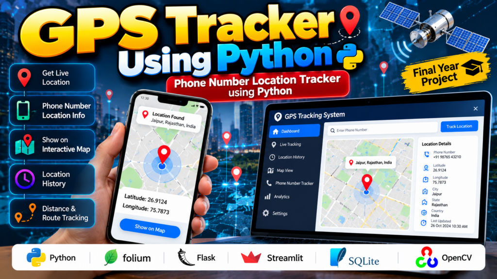
📍 GPS Tracker Using Python is a location-based project that demonstrates how Python can be used to collect, process and display geographical location information on a map.
🎓 For students, this can be developed as a Python, GPS, IoT, Geolocation or final-year project. A consent-based version can allow a user to share their own device location and display it on a web map.
The term “Phone Number Location Tracker” is often used for projects that identify general information associated with a phone number. However, a phone number alone cannot legitimately provide someone’s precise live GPS location. Real-time location tracking requires the device user’s consent and an appropriate location-sharing mechanism.
📍 What Is a GPS Tracker Using Python?
A GPS tracker is an application that obtains geographical coordinates such as latitude and longitude and displays or processes them.
A GPS Tracker Using Python can be developed as a web-based application that receives authorized location data and displays the user’s location on an interactive map.
A basic system can follow this workflow:
Location Source → Latitude & Longitude → Python Processing → Map → Location Display
Depending on the project design, the location source can be:
- GPS-enabled device
- Smartphone location sharing
- IoT GPS module
- Browser geolocation
- Authorized location API
- Simulated GPS coordinates for academic demonstration
🎓 What Is a Phone Number Location Tracker?
A Phone Number Location Tracker Using Python should be understood carefully.
A phone number by itself does not give a Python program access to a person’s live GPS coordinates.
A legitimate student project can instead use a phone number to identify an authorized user account and then display location information that the user has voluntarily shared.
For example:
User Registration
       ↓
Phone Number Verification
       ↓
User Gives Location Permission
       ↓
Location Coordinates
       ↓
Python Application
       ↓
Map Display
This approach makes the project more realistic while respecting user privacy.
⚙️ How Does a GPS Tracker Using Python Work?
1. Obtain Location Data
The application first obtains latitude and longitude from an authorized source.
For example:
Latitude: 26.9124
Longitude: 75.7873
These coordinates can then be processed by Python.
2. Process the Coordinates
Python can receive and process the location data.
The application can:
- Store coordinates
- Calculate distances
- Display location history
- Convert coordinates into map markers
- Generate routes
- Calculate movement information
3. Display the Location on a Map
The coordinates can be displayed using mapping technologies.
A map interface can show:
📍 Current Location
Latitude: XX.XXXX
Longitude: XX.XXXX
Libraries such as Folium can be used to create interactive maps in Python.
4. Store Location History
An authorized application can store previous coordinates in a database.
For example:
| Time | Latitude | Longitude |
|---|---|---|
| 10:00 AM | 26.9124 | 75.7873 |
| 10:05 AM | 26.9131 | 75.7890 |
| 10:10 AM | 26.9140 | 75.7902 |
This can be used to visualize a user’s voluntarily shared movement history.
🐍 Technologies Used
| Technology | Purpose |
|---|---|
| Python | Main programming language |
| GPS | Location source |
| Geolocation API | Location services |
| Folium | Interactive maps |
| Flask | Web application |
| Streamlit | Python-based interface |
| SQLite/MySQL | Location data storage |
| HTML/CSS | User interface |
| JavaScript | Browser geolocation |
The exact technology stack can be selected according to the project requirements.
🗺️ Python GPS Tracker Example
A simple academic demonstration can create a map using coordinates.
import folium

latitude = 26.9124
longitude = 75.7873

location_map = folium.Map(
    location=[latitude, longitude],
    zoom_start=15
)

folium.Marker(
    [latitude, longitude],
    popup="Shared Location"
).add_to(location_map)

location_map.save("gps_tracker.html")
This example demonstrates how Python can display authorized latitude and longitude information on an interactive map.
📱 How Can a Phone Share Its Location?
A practical project can use a smartphone or browser to obtain location information after the user grants permission.
The workflow can be:
Smartphone
    ↓
Location Permission
    ↓
GPS / Device Location
    ↓
Latitude + Longitude
    ↓
Python Backend
    ↓
Database
    ↓
Interactive Map
This is a more appropriate implementation than attempting to derive a person’s live location solely from their phone number.
🔐 Phone Number Verification
A phone number can still be useful in a legitimate location-sharing application.
For example:
Phone Number
     ↓
Account Registration
     ↓
Verification
     ↓
Location Permission
     ↓
Authorized Location Sharing
The phone number identifies the user’s account, while the location comes from the user’s authorized device or location-sharing service.
📊 GPS Tracking Dashboard
A student project can include a dashboard displaying:
- Current location
- Latitude
- Longitude
- Last update time
- Location history
- Distance travelled
- Map view
- User status
A simple dashboard could look like:
----------------------------------
       GPS TRACKER DASHBOARD
----------------------------------

📍 Current Location

Latitude:  26.9124
Longitude: 75.7873

Last Updated: 10:30 PM

[ View Location on Map ]

----------------------------------
🚀 Features of the GPS Tracker
Real-Time Location Display
The system can display the latest location voluntarily shared by the user.
Interactive Map
An interactive map can show the current position using a marker.
Location History
Previous locations can be stored for authorized users.
Distance Calculation
Python can calculate the approximate distance between two coordinates.
Route Visualization
Location points can be connected to visualize movement.
User Authentication
Users can securely access their own location information.
Mobile-Friendly Interface
The dashboard can be designed to work on smartphones and computers.
📏 Distance Calculation Using Python
The distance between two GPS coordinates can be calculated using geographic formulas such as the Haversine formula.
For example:
from math import radians, sin, cos, sqrt, atan2

def calculate_distance(lat1, lon1, lat2, lon2):
    earth_radius = 6371

    dlat = radians(lat2 - lat1)
    dlon = radians(lon2 - lon1)

    a = (
        sin(dlat / 2) ** 2
        + cos(radians(lat1))
        * cos(radians(lat2))
        * sin(dlon / 2) ** 2
    )

    c = 2 * atan2(sqrt(a), sqrt(1 - a))

    return earth_radius * c

distance = calculate_distance(
    26.9124, 75.7873,
    26.9140, 75.7902
)

print("Distance:", distance, "km")
This can be useful for calculating the distance between two authorized location points.
🌐 Applications of a Python GPS Tracker
A consent-based GPS tracking application can be explored for:
- Personal location sharing
- Fleet management
- Delivery tracking
- Vehicle tracking
- Asset monitoring
- Travel applications
- Logistics
- IoT projects
- Emergency location sharing
- Academic geolocation projects
🎓 GPS Tracker as a Final-Year Project
A GPS Tracker Using Python can be developed as a practical B.Tech, BE, BCA or MCA final-year project.
🎓 A GPS Tracker Using Python is a practical choice for students interested in Python, IoT, GPS and geolocation-based projects.
Students can combine:
- Python
- GPS
- Geolocation
- APIs
- Database
- Web Development
- Maps
- IoT
The project can start with basic coordinate display and gradually be expanded into a complete location management application.
🚗 Vehicle GPS Tracking System
An advanced version can combine Python with a GPS module installed on a vehicle.
The GPS device can periodically send:
Latitude
Longitude
Speed
Timestamp
to a server.
The Python application can then display the vehicle’s latest authorized location on a dashboard.
GPS Module
     ↓
Internet / Communication
     ↓
Python Server
     ↓
Database
     ↓
Tracking Dashboard
🚚 Fleet Tracking System
The same concept can be extended to multiple authorized vehicles.
A fleet dashboard could display:
| Vehicle | Status | Last Location |
|---|---|---|
| Vehicle 01 | Active | Map |
| Vehicle 02 | Active | Map |
| Vehicle 03 | Offline | Last Known Location |
This can turn a simple GPS project into a more advanced IoT and fleet-management project.
🔮 Future Scope
The project can be enhanced with:
Geofencing
Create predefined geographic boundaries and generate notifications when an authorized device enters or leaves them.
Route History
Display previously shared locations on a map.
Distance and Travel Analytics
Calculate total distance travelled over a selected period.
IoT GPS Integration
Connect the system to GPS-enabled hardware.
Mobile Application
Create a mobile application for location sharing and tracking.
Cloud Database
Store authorized location data in a cloud database.
Emergency Location Sharing
Allow a user to voluntarily share their current location during an emergency.
🔐 Privacy and Security
Location information is sensitive data, so a real-world tracking application should implement appropriate privacy protections.
A good project should include:
- User consent
- Authentication
- Secure data transmission
- Access control
- Limited data retention
- Protected location history
- Clear location-sharing controls
A phone number alone should not be presented as a way to obtain someone’s precise live GPS location.
For a college project, demonstrating consent-based location sharing is both technically more realistic and more appropriate.
🚀 Recommended Python & AI Projects
If you are interested in GPS, Python, IoT and Computer Vision projects, explore related project ideas:
Vehicle Detection and Counting Using Python
Detect and count vehicles from traffic video using Computer Vision.
Accident Detection and Alert System Using Machine Learning
Analyze traffic footage to identify possible accident events.
Smart Agriculture and Automatic Irrigation
Build an IoT-based system for monitoring agricultural conditions.
Smart Home Automation Using IoT
Control and monitor home appliances using IoT technologies.
Object Detection and Recognition Using Python
Build a real-time object detection system using Python and Computer Vision.
🎓 Looking for a customized Python, IoT or AI project? Share your requirements with Techie Projects and discuss the project scope, features and customization options.
📦 What Can Be Included in the Complete Project?
Depending on the selected scope, the project can include:
- Python Source Code
- GPS/Geolocation Integration
- Database
- Interactive Map
- Web Interface
- Project Documentation
- Project Report
- PPT Presentation
- System Architecture
- Flowcharts
- Demo
- Viva Preparation
- Feature Customization
🎓 Need a GPS or Python Project?
Are you looking for a Python, GPS, IoT, Machine Learning or Computer Science final-year project?
Techie Projects can help students develop and customize projects according to their academic requirements.
Have an existing project idea? Share the requirements and discuss the features, technology stack and project scope.
📞 Contact Techie Projects
Contact us for project-related queries and requirements.
📲 Call/WhatsApp: +91-9460060699
🌎 Website: www.techieprojects.com
Share your project requirements with us and discuss the scope, features and customization options.
Frequently Asked Questions
Can Python be used to build a GPS Tracker?
Yes. Python can process GPS coordinates, store location information and display authorized locations on interactive maps.
Can a phone number provide someone’s live GPS location?
No. A phone number by itself does not provide a Python application with someone’s precise live GPS coordinates. Live location requires an authorized location-sharing mechanism and user permission.
Can I build a Phone Number Location Tracker as a college project?
Yes, but it should be implemented as a consent-based system, where the phone number identifies an authorized user account and the user’s device voluntarily shares its location.
Which Python library can be used to display GPS locations?
Folium is one option for creating interactive maps in Python.
Can GPS coordinates be stored in a database?
Yes. Latitude, longitude and timestamps can be stored in databases such as SQLite or MySQL for authorized tracking applications.
Can the GPS Tracker work in real time?
Yes. An advanced system can periodically receive location updates from an authorized device and display the latest location.
Can this project be connected to an IoT GPS module?
Yes. A GPS module can send coordinates to a Python server through an appropriate communication method.
Is this suitable for a B.Tech final-year project?
Yes. A GPS tracking project can be developed as a Python, IoT, Geolocation or Web Development final-year project.
Conclusion
📍 GPS Tracker Using Python is a practical project that demonstrates how Python can process geographical coordinates, calculate distances, store location information and display authorized locations on an interactive map.
🚀 The GPS Tracker Using Python project can also be customized with GPS hardware, geofencing, location history and a real-time tracking dashboard.
🎓 For students, the project can be expanded with phone verification, consent-based location sharing, GPS modules, databases, geofencing, route history, IoT integration and web dashboards.
The Phone Number Location Tracker Using Python concept should be implemented responsibly: the phone number can identify an authorized account, while actual location data should come from the user’s device or an authorized location-sharing mechanism.
🚀 Have a similar Python, GPS or IoT project idea?
📲 Call/WhatsApp: +91-9460060699
🌎 Visit: www.techieprojects.com
Discuss your project requirements with Techie Projects and get started with your customized project.