
Introduction
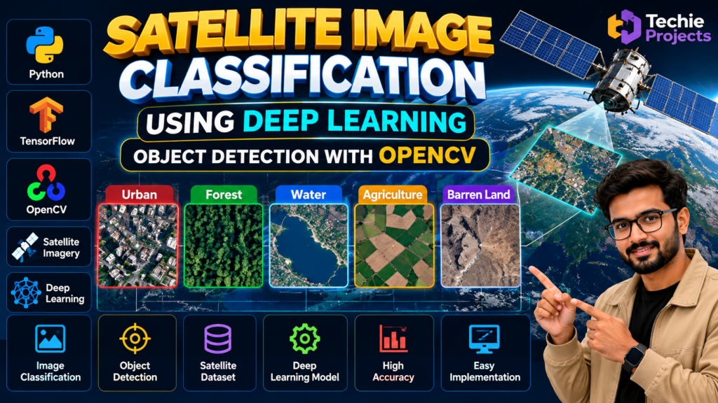
Satellite image classification using deep learning is an artificial intelligence project that explores how neural networks can analyze satellite images and classify land-cover patterns. This project is suitable for B.Tech, B.E., BCA, MCA, and computer science engineering students interested in Python programming, deep learning, computer vision, and remote sensing.
Satellite imagery contains valuable visual information about urban areas, forests, agricultural land, water bodies, and other geographical features. Deep learning models can learn patterns from labeled satellite images and use them to classify images or regions into predefined categories.
This satellite image classification using deep learning project helps students understand image preprocessing, model training or inference, classification workflows, and visual analysis using Python. Depending on the implementation, OpenCV can support image processing, while a trained deep learning model performs the classification task.
🎥 Watch the Satellite Image Classification Using Deep Learning Working Demo
Watch the Satellite Image Classification Using Deep Learning Project Demo to see how the application processes satellite images and displays classification results.
The demonstration helps students understand the project interface, image-processing workflow, and implemented classification features. It also provides a practical overview of how Python, deep learning, and OpenCV can be used to analyze satellite imagery.
Watch the video below to explore the project in action.
What Is Satellite Image Classification Using Deep Learning?
Satellite image classification is the process of assigning satellite images or image regions to predefined categories based on their visual characteristics. These categories may include urban areas, forests, water bodies, agricultural land, and barren land.
Deep learning models can learn visual patterns from labeled examples and use those patterns to classify new images. The classification method depends on the selected model, dataset, and intended output.
OpenCV can help load, resize, display, and preprocess images. A deep learning framework such as TensorFlow or PyTorch may be used to train or run the classification model, depending on the project implementation.
Satellite image classification using deep learning helps students explore how neural networks identify land-cover patterns in satellite imagery. This project demonstrates practical applications of Python, image processing, and deep learning for remote sensing analysis.
🎯 Objectives of the Project
The main objectives of this satellite image classification project are:
- Develop a satellite image analysis application using Python.
- Understand deep learning and image classification.
- Learn how satellite images are preprocessed for model input.
- Explore visual patterns in different land-cover categories.
- Integrate a trained model into an image-processing workflow.
- Display classification results through an application interface.
- Demonstrate practical applications of computer vision and remote sensing.
✨ Key Features of the Satellite Image Classification System
1. Satellite Image Input
The application can accept compatible satellite images for analysis using the input method supported by the project.
2. Image Preprocessing
Image preprocessing may include resizing, normalization, format conversion, and other operations required by the selected model.
3. Deep Learning-Based Classification
A trained model can analyze image features and predict the category associated with an input image or region.
4. Land-Cover Category Recognition
Depending on the training dataset and model, supported categories may include urban areas, forests, water, agriculture, and barren land.
5. OpenCV Integration
OpenCV can support image loading, preprocessing, visualization, and other computer vision operations.
6. Classification Results
The application can display the predicted class, label, or other model output through its interface.
7. Extendable Architecture
The project can be extended with additional classes, improved models, or more advanced image analysis techniques where the implementation supports them.
Important: Image classification and object detection are different tasks. Do not claim bounding-box detection or object-level identification unless your supplied project implements those capabilities.
🛠️ Technologies Used
The following technologies may be used in a satellite image classification project, depending on the actual source code:
- Python: Main programming language.
- Deep Learning: Learns visual patterns from training data.
- OpenCV: Supports image processing and visualization.
- TensorFlow or Keras: May be used to build or run neural network models.
- PyTorch: An alternative framework for deep learning.
- NumPy: Supports numerical operations and data processing.
- Satellite Image Dataset: Provides images for training, testing, or inference.
The exact libraries, model architecture, dataset, and software versions should be confirmed from the supplied project.
⚙️ How Satellite Image Classification Using Deep Learning Works
The general workflow includes the following steps:
- Image Collection: Obtain satellite images suitable for the intended classification task.
- Image Preprocessing: Prepare images according to the model’s input requirements.
- Dataset Preparation: If training is included, organize images and their corresponding labels.
- Model Training or Loading: Train a model using labeled data or load an existing trained model.
- Image Classification: Pass the prepared image through the model to generate a prediction.
- Result Display: Present the predicted category or other supported output through the application.
- Evaluation: When evaluation functionality is available, compare predictions against labeled test data to assess performance.
This workflow introduces students to the main stages of a deep learning image classification application.
💻 Software Requirements
Typical requirements may include:
- Operating System: Windows or another supported platform
- Programming Language: Python
- IDE: Visual Studio Code, PyCharm, or another compatible editor
- Libraries: OpenCV, NumPy, and the packages required by the model
- Deep Learning Framework: TensorFlow, Keras, PyTorch, or another framework, depending on the implementation
- Dataset: Compatible satellite images for training, testing, or inference
- Hardware: A computer capable of running the selected model
Actual requirements depend on the model size, image resolution, Python version, and whether model training is included.
🎓 Applications of Satellite Image Classification
Satellite image classification has potential applications in:
- Land-cover mapping
- Forest and vegetation monitoring
- Agricultural land analysis
- Water-body identification
- Urban development research
- Environmental monitoring
- Remote sensing education
- Geographic information analysis
These applications depend on suitable imagery, model validation, and the classification categories supported by the implementation.
✅ Advantages of the Project
- Demonstrates practical deep learning concepts.
- Helps students learn Python-based image processing.
- Introduces satellite imagery and remote sensing.
- Provides experience integrating trained models into applications.
- Can be extended with additional image classes.
- Supports academic demonstrations and technical presentations.
🚀 Future Scope
The project can be extended with additional features, depending on its architecture and resources:
- Add more land-cover categories.
- Evaluate alternative deep learning architectures.
- Improve image preprocessing methods.
- Support batch processing of satellite images.
- Display classification results on a map.
- Explore semantic segmentation for pixel-level land-cover analysis.
- Evaluate performance using suitable test datasets.
- Develop a web-based interface for easier access.
Any performance improvements should be measured using appropriate test data rather than assumed.
🛒 Purchase the Satellite Image Classification Project
Are you looking for a satellite image classification using deep learning project for your final-year engineering submission, computer vision assignment, or machine learning portfolio?
Techie Projects can help you enquire about project availability, source code, model files, installation requirements, included features, and customization options.
Before purchasing, discuss your academic requirements with us and confirm whether the available implementation includes model training, a pretrained model, dataset files, classification output, or any additional features you need.
📲 Contact Us on WhatsApp
Get Satellite Image Classification Project Details and Pricing
🌐 Website: Techie Projects
📸 Instagram: Explore Techie Projects
🔗 Explore Related Projects
Explore these related project categories for more engineering project ideas:
- Object Detection Using OpenCV Python
- Image Classification Using CNN
- Crop Classification Using Machine Learning
- Forest Fire Detection Using Deep Learning
- Machine Learning Projects
- Deep Learning Projects
❓ Frequently Asked Questions
1. What is satellite image classification using deep learning?
It is a computer vision task that uses a trained deep learning model to classify satellite images or image regions into predefined categories.
2. Which programming language is used in this project?
Python is commonly used because it supports image processing, deep learning frameworks, and model inference.
3. What is the role of OpenCV in this project?
OpenCV can be used to load, resize, process, and display images. The deep learning model performs the classification when integrated into the application.
4. Is image classification the same as object detection?
No. Image classification assigns a label to an image or region, while object detection identifies objects and typically locates them with bounding boxes. The available functionality depends on the implemented model.
5. Is this project suitable for final-year engineering students?
It can be suitable for students studying computer science, artificial intelligence, machine learning, or computer vision, depending on their institutional requirements.
6. How can I purchase this project?
Contact Techie Projects through WhatsApp to enquire about source code, model files, dataset availability, installation requirements, and pricing.
Conclusion
Satellite image classification using deep learning is a practical educational project that introduces students to image preprocessing, neural network inference, and satellite imagery analysis.
By exploring the project workflow, students can learn how Python and deep learning models can be used to classify visual information from satellite images. If you need this project for your academic work, contact Techie Projects to discuss the available implementation, source code, customization options, and pricing.