
Introduction
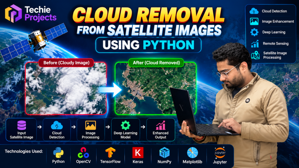
Cloud removal from satellite images using Python is an exciting image processing project for students interested in computer vision, deep learning, and remote sensing. This project focuses on improving the visibility of satellite images by reducing cloud interference, helping users explore clearer visual information for analysis and research.
If you are looking for a Cloud Removal from Satellite Images project for your final-year engineering submission, Techie Projects can help you explore a project solution with Python implementation, project guidance, and customization options.
🎬 Cloud Removal from Satellite Images – Project Demo Video
Watch the project demonstration to understand how the cloud removal system works, how satellite images are processed, and how Python-based image processing techniques can support remote sensing applications.
The demo introduces the project workflow and provides a visual overview of the system for students planning their final-year project.
🌍 What Is Cloud Removal from Satellite Images?
Satellite images are widely used in agriculture, environmental monitoring, land-use analysis, disaster management, and geographical research. However, clouds can cover important areas and reduce the amount of visible information in an image.
The cloud removal from satellite images using Python project explores computational techniques for reducing cloud interference and improving the usability of satellite imagery. Depending on the implemented method and available data, the system may use image preprocessing, image enhancement, or deep learning-based approaches.
The final output depends on the model, dataset, and processing method used. Reconstructed areas should not be treated as guaranteed representations of the actual ground conditions.
🎯 Project Objectives
The main objectives of this project are:
- 🌤️ Explore techniques for reducing cloud interference in satellite images.
- 🛰️ Process satellite imagery using Python-based tools.
- 🖼️ Compare input images with processed outputs.
- 🤖 Understand how image processing and deep learning can support remote sensing.
- 📊 Evaluate output quality using suitable image-quality metrics when reference images are available.
- 🎓 Build practical knowledge of computer vision for an academic project.
⚙️ How Does the Project Work?
The workflow may include the following stages, depending on the implementation:
1. Satellite Image Input
The system receives satellite images containing clouds or other visual obstructions.
2. Image Preprocessing
The input images are prepared for processing through operations such as resizing, normalization, or other suitable preprocessing techniques.
3. Cloud Identification
The selected approach identifies cloud-covered regions using image-processing rules, a cloud mask, or a trained model.
4. Cloud Removal or Image Reconstruction
The implementation applies its selected restoration method to reduce cloud interference. A deep learning approach may estimate missing visual details using suitable training data.
5. Output Visualization
The system displays the original and processed images so users can examine the differences.
6. Performance Evaluation
Where appropriate, the results can be evaluated using metrics such as PSNR or SSIM when suitable reference images are available.
🧰 Technologies Used
The exact technology stack depends on the selected implementation. A typical version of this project may use:
- Programming language: Python
- Image processing: OpenCV and Pillow
- Numerical computing: NumPy
- Deep learning: TensorFlow/Keras or PyTorch, if the implementation uses a neural network
- Visualization: Matplotlib
- Interface: A Python GUI or web interface, depending on the project version
💻 Software and Hardware Requirements
Software Requirements
- Python environment
- Required Python libraries for image processing or model inference
- Compatible operating system
- Dataset and model files required by the selected implementation
Hardware Requirements
- Computer or laptop
- Sufficient RAM and storage for the dataset
- GPU acceleration may be helpful for deep learning models, but requirements depend on the implementation
Confirm the final requirements before purchasing or installing the project.
🚀 Key Project Features
The project can demonstrate the following capabilities when supported by the chosen implementation:
- Satellite image upload and processing
- Original-versus-processed image comparison
- Cloud interference reduction
- Image enhancement and visualization
- Python-based image processing workflow
- Potential integration of a deep learning model
- Academic evaluation and experimentation
🎓 Applications of Satellite Image Cloud Removal
🌱 Agriculture
Improved satellite imagery can support the study of crop patterns and agricultural land, subject to image quality and processing limitations.
🌳 Environmental Monitoring
Researchers can explore satellite images for vegetation, land-cover, and environmental analysis.
🗺️ Land-Use Analysis
Cloud-reduced imagery may help students study geographical features and land-use patterns.
🌊 Disaster Management
Satellite imagery can contribute to disaster assessment when usable imagery is available. Reconstructed regions should be validated before being used for operational decisions.
🔬 Research and Education
The project provides a practical way to explore image restoration, computer vision, and remote sensing concepts.
🛒 Get the Cloud Removal from Satellite Images Project
Are you searching for a Cloud Removal from Satellite Images using Python project for your final-year engineering project, mini project, or academic demonstration?
Techie Projects offers project assistance for students who want to explore Python, image processing, and deep learning applications. Contact us to confirm the available implementation, source code, documentation, demonstration, and customization options before ordering.
📲 Call/WhatsApp: +91-9460060699
🌎 Website: www.techieprojects.com
📺 Instagram: @pythonprojects_
Ask about the current project package, delivery format, setup support, and any customization required for your academic guidelines.
❓ Frequently Asked Questions
1. What is a cloud removal from satellite images project?
It is an image-processing project that explores methods for reducing cloud interference in satellite imagery to make images more useful for visualization and analysis.
2. Which programming language is used?
Python is the primary programming language for the project. Libraries depend on the selected implementation.
3. Is this project suitable for final-year CSE students?
It can be suitable for computer science and engineering students interested in image processing, computer vision, machine learning, or remote sensing, subject to their institution’s project requirements.
4. Does cloud removal always recover the original image?
No. Cloud-covered ground details may be missing from the input. A model can estimate those details, but the result may not match the true ground conditions.
5. Can the project be customized?
Customization may be possible depending on the available project version. Contact Techie Projects to discuss specific requirements before placing an order.
6. How can I purchase this project?
Contact Techie Projects through WhatsApp at https://wa.me/919460060699 to confirm availability, pricing, deliverables, and support options.
🎓 Explore Related Projects
Explore more project ideas in related technical areas:
- Satellite Image Classification Using Deep Learning
- Oil Spill Detection Using Machine Learning
- Underwater Image Enhancement using Deep Learning
- Real-Time Dehazing for Image and Video using Image Processing
- Object Detection Using Computer Vision
Browse more project ideas at Techie Projects.
✅ Conclusion
Cloud removal from satellite images using Python is a useful academic project for exploring image processing, computer vision, and remote sensing. It offers opportunities to study preprocessing, cloud identification, image restoration, and output evaluation in a practical workflow.
If you want to develop your understanding through a ready-to-explore project, contact Techie Projects to check availability and purchase options. Confirm the source code, documentation, setup instructions, and support included in your selected package before ordering.