
🎓 Introduction
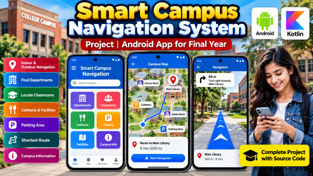
A Smart Campus Navigation System Project is an Android-based application designed to help students, faculty members, visitors, and staff navigate a large college or university campus easily. The application can provide information about classrooms, departments, laboratories, libraries, cafeterias, parking areas, administrative blocks, and other important campus locations.
For students, this project is a practical Android app project for final year, demonstrating mobile application development, user interface design, location-based services, navigation, and database integration.
The project can be developed using Android Studio, Kotlin, and Firebase or another suitable database depending on the required implementation.
🎥 Watch the Smart Campus Navigation System Project Working Demo
Before choosing or purchasing a project, students can watch the Smart Campus Navigation System Project working demo to understand the application’s interface, navigation flow, features, and overall working.
The working video demonstrates how users can search for campus locations and navigate between important places such as departments, classrooms, libraries, cafeterias, and parking areas.
🏫 What Is a Smart Campus Navigation System?
A Smart Campus Navigation System is a mobile application that helps users find locations within a college or university campus.
Instead of asking other students or staff for directions, users can open the application, search for a location, and view the available route.
The system can be particularly useful for:
- New students
- Visitors
- Faculty members
- College staff
- Parents
- Students attending different departments
- Students attending events or examinations
The application can make campus navigation faster, easier, and more convenient.
🎯 Objectives of the Smart Campus Navigation System
The major objectives of this project include:
- Provide easy campus navigation through an Android application.
- Help students locate classrooms and departments.
- Display important campus facilities.
- Provide directions between different campus locations.
- Reduce confusion for new students and visitors.
- Provide centralized campus location information.
- Create a practical Android project for students.
- Demonstrate mobile application development skills.
📱 Key Features
The Smart Campus Navigation System can include several useful features.
1. Campus Map
The application can display a digital representation of the campus with important buildings and locations.
2. Location Search
Users can search for locations such as:
- Main Library
- Computer Science Department
- Administration Block
- Classrooms
- Laboratories
- Cafeteria
- Parking Area
- Examination Hall
3. Department Finder
Students can search for a particular department and view its location.
4. Classroom Navigation
The application can help students find classrooms and academic blocks.
5. Library Navigation
Users can quickly locate the college library and receive navigation instructions.
6. Cafeteria and Facility Locations
Important facilities such as cafeterias, laboratories, medical rooms, parking areas, and student centers can be included.
7. Shortest Route
The application can provide a suitable route between the user’s selected location and destination.
8. Campus Information
The application can display information about different buildings and facilities.
9. User-Friendly Interface
The application can provide a simple interface so that even first-time users can easily search and navigate around the campus.
⚙️ How the Smart Campus Navigation System Works
The basic working process can be divided into several steps.
Step 1: Open the Application
The user opens the Smart Campus Navigation application on an Android smartphone.
Step 2: Search for a Location
The user searches for a destination such as the library, classroom, department, cafeteria, or administrative block.
Step 3: Select the Destination
The application displays the available location and related information.
Step 4: Display the Campus Map
The selected destination is displayed on the campus map.
Step 5: Generate the Route
The application calculates or displays a suitable route from the current or selected starting point to the destination.
Step 6: Navigate to the Destination
The user follows the displayed route to reach the selected location.
🛠️ Technologies Used
Depending on the implementation, the project can use technologies such as:
- Android Studio
- Kotlin
- XML
- Firebase
- Google Maps API
- Android SDK
- Location Services
- Database
- Material Design Components
The exact technology stack can be modified according to the project requirements.
💻 Software Requirements
Typical software requirements for developing this project include:
- Android Studio
- Kotlin
- Android SDK
- JDK
- Firebase or suitable database
- Google Maps API, if map-based navigation is implemented
- Windows, macOS, or Linux development environment
📱 Hardware Requirements
Basic hardware requirements may include:
- Computer or laptop
- Minimum 4 GB RAM
- Recommended 8 GB RAM or more
- Internet connection
- Android smartphone for testing
- GPS-enabled device for location-based features
🗄️ Database Design
A database can be used to store information about campus locations.
Possible database entities include:
Location Table
The location information can contain:
- Location ID
- Location Name
- Building Name
- Department
- Description
- Latitude
- Longitude
- Floor
- Contact Information
User Table
The user information may contain:
- User ID
- Name
- Password
- User Type
Facility Table
The facility section can contain information about:
- Facility name
- Location
- Opening hours
- Description
The database structure can be customized according to the requirements of the college.
🗺️ Campus Navigation Workflow
A basic navigation workflow can be represented as:
User → Search Location → Select Destination → Campus Map → Route Generation → Navigation → Destination
This workflow makes the application easy to understand and can also be explained during a final-year project presentation.
🎓 Why Is This a Good Final-Year Project?
The Smart Campus Navigation System is a useful final-year engineering project because it combines multiple areas of software development.
Students can demonstrate knowledge of:
- Android development
- Kotlin programming
- UI/UX design
- Database management
- API integration
- Location services
- Mobile application architecture
- Problem-solving
- Software testing
The project can also be extended with additional technologies to make it more advanced.
🚀 Advanced Features You Can Add
Students can extend the project with additional features such as:
- Indoor navigation
- QR-code-based navigation
- Voice navigation
- GPS tracking
- Real-time location sharing
- Emergency location services
- Event location finder
- Smart parking
- Bus tracking
- College notification system
- AI-based campus assistant
- Chatbot for campus enquiries
- AR-based navigation
- Multi-floor building navigation
- Admin dashboard
- Push notifications
These features can help transform a basic campus navigation application into a more advanced smart-campus solution.
💡 Project Ideas You Can Add
Students can also develop related modules around the same concept:
- Smart College Campus App
- College Bus Tracking System
- Campus Event Management System
- College Enquiry Chatbot
- Student Attendance Management System
- College Navigation App
- Smart Parking Management System
- College Facility Management System
👨💻 Who Can Use This Project Idea?
This project can be suitable for students pursuing:
- B.Tech
- B.E.
- BCA
- MCA
- Computer Science
- Information Technology
- Software Engineering
- Android Development
It can be developed as a mini project, major project, final-year project, academic project, or resume project, depending on its implementation and scope.
📊 Advantages of the Smart Campus Navigation System
Some major advantages include:
- Easy access to campus locations
- Reduces navigation difficulties
- Helpful for new students
- Useful for visitors
- Centralized campus information
- Easy-to-use mobile interface
- Can be expanded with advanced features
- Provides practical Android development experience
🔮 Future Scope
The future scope of this project is broad. A basic campus navigation application can be converted into a complete smart-campus platform.
Future versions could integrate:
- Artificial Intelligence
- Augmented Reality
- IoT devices
- Real-time GPS
- Smart sensors
- Voice assistants
- AI chatbots
- Cloud services
- Real-time campus notifications
For example, an AI-powered assistant could allow students to ask questions such as “Where is the Computer Science Department?” and automatically provide directions.
❓ Frequently Asked Questions
Is Smart Campus Navigation System a good final-year project?
Yes. It can be a practical final-year project because it combines Android development, navigation, databases, APIs, and user-interface design.
Which programming language can be used?
Kotlin is a suitable choice for modern Android application development. Java can also be used depending on the project requirements.
Can this project use Google Maps?
Yes. Google Maps or another mapping solution can be integrated when map-based navigation is required.
Can the project work without internet?
Some basic campus information can be stored locally, but real-time maps, cloud databases, and certain location services may require an internet connection.
Can an admin panel be added?
Yes. An admin panel can be developed to manage campus buildings, departments, classrooms, facilities, and other location information.
Can this project be converted into a real college application?
Yes. With additional development, testing, accurate campus mapping, authentication, database management, and deployment, the concept can be adapted for a real college environment.
Can additional features be added to the project?
Yes. Students can add voice navigation, QR navigation, smart parking, AI chatbot, event navigation, real-time GPS, and other modules according to their project requirements.
🔗 Explore Related Engineering Projects
Students looking for similar project ideas can also explore:
- Android App Projects
- College Management System Projects
- College Admission Enquiry Chatbot
- Student Attendance Management System
- Smart Parking Management System
- Campus Recruitment System
- Fake News Detection using Machine Learning
- Final-Year Engineering Projects
🎓 Looking for a Final-Year Project?
Choosing the right project depends on your course, technology, project requirements, features, source-code requirements, documentation, and project scope.
Techie Projects can help students discuss their project requirements before development or purchase.
📲 WhatsApp: +91-9460060699
🌐 Website: Techie Projects
📸 Instagram: @pythonprojects_
🎯 Conclusion
The Smart Campus Navigation System Project is a practical Android application concept that can help students and visitors navigate a college or university campus more efficiently.
The project provides opportunities to implement Android development, Kotlin, maps, location services, databases, APIs, and modern mobile application interfaces. Students can also extend the basic application with AI, AR, voice navigation, smart parking, chatbot functionality, and real-time campus services.
For a final-year project, the system provides a strong foundation that can be customized according to the student’s academic requirements and project scope.