
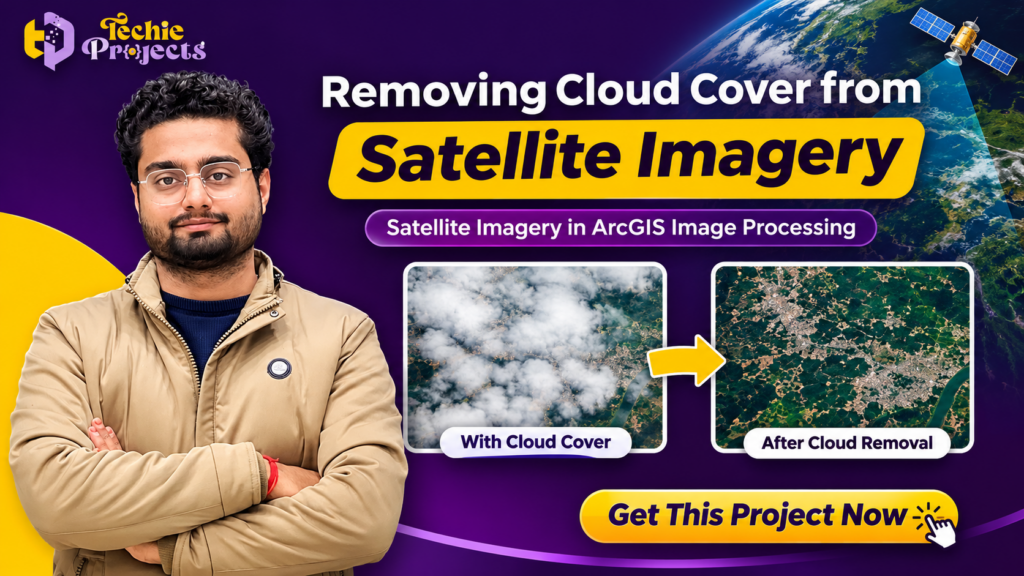
Looking for a ready-to-use Removing Cloud Cover from Satellite Imagery project for your final-year engineering submission? 🚀 Techie Projects offers a practical satellite image processing project designed for students who want to explore image processing, Python programming, remote sensing, and geospatial technology.
Cloud-covered satellite images can make it difficult to observe the Earth’s surface, identify geographical features, monitor agricultural land, and perform environmental analysis. This project focuses on processing satellite imagery to reduce the visual obstruction caused by clouds and improve the usability of satellite images. Removing Cloud Cover from Satellite Imagery is an interesting application of Python-based image processing for students exploring remote sensing technology.
🎓 If you are an engineering student working on a B.Tech, M.Tech, MCA, BCA, or computer science final-year project, this solution can help you understand real-world satellite image processing applications.
Get your project from Techie Projects! We provide engineering projects across Python, Artificial Intelligence, Machine Learning, Deep Learning, IoT, Image Processing, and Data Science domains. Contact us to discuss project availability, source code, implementation details, and customization according to your academic requirements.
📞 Contact Techie Projects for Project Enquiries
Interested in purchasing this project? Contact our team for project details, pricing, and availability.
- 📞 Contact Number/📱 WhatsApp: +91 94600 60699
- 🌐 Website: www.techieprojects.com
- 📸 Instagram: @pythonprojects_
We can help you choose a suitable engineering project and understand its implementation requirements.
🎬 Watch the Removing Cloud Cover from Satellite Imagery Project Demo
Explore the project demonstration to understand how the application works and how satellite images can be processed to reduce cloud obstruction.
Project: Removing Cloud Cover from Satellite Imagery
Technology: Python and ArcGIS Image Processing
📌 Introduction to Removing Cloud Cover from Satellite Imagery
Satellite imagery plays an important role in modern technology. It is widely used in agriculture, environmental monitoring, urban planning, disaster management, geographical information systems, and weather observation.
Satellites capture images of the Earth’s surface from space. However, clouds frequently cover portions of the captured images, making it difficult to obtain clear information about the underlying geographical areas.
For example, when researchers analyze agricultural land using satellite images, cloud coverage can hide important details such as crop patterns, vegetation conditions, and land characteristics.
The Removing Cloud Cover from Satellite Imagery project focuses on addressing this challenge through image processing techniques.
The application provides a platform for working with satellite images and applying cloud removal processing to improve image visibility. It demonstrates how programming and geospatial image processing can be combined to solve a practical problem in remote sensing.
This project is especially useful for students interested in Python development, image processing, satellite technology, and geographical data analysis.
☁️ What Is Cloud Removal from Satellite Images?
Cloud removal is a satellite image processing technique used to reduce or reconstruct the visual obstruction caused by clouds in satellite imagery.
Clouds can hide surface information and affect the quality of images collected by satellites. This creates difficulties when comparing images, monitoring environmental changes, or studying geographical regions.
Cloud removal techniques attempt to recover or estimate the information hidden beneath cloud-covered regions.
Depending on the available data and processing method, cloud removal can involve:
- Image enhancement techniques.
- Cloud detection and masking.
- Image restoration.
- Multi-temporal satellite image analysis.
- Pixel reconstruction techniques.
- Machine learning and deep learning approaches.
The selection of a particular technique depends on the satellite data, cloud coverage, image quality, and desired output.
An important consideration is that cloud removal does not always recover the exact original surface information. The accuracy of reconstructed regions depends on the availability of suitable reference imagery and the processing algorithm.
🎯 Objectives of the Project
The main objective of the Removing Cloud Cover from Satellite Imagery project is to demonstrate satellite image processing and improve the visibility of cloud-affected images.
The major objectives include:
- To understand satellite image processing concepts.
- To process satellite images using Python-based technologies.
- To reduce cloud-related visual obstruction in satellite imagery.
- To explore image processing techniques for satellite image enhancement.
- To develop an application for working with satellite image data.
- To understand the importance of remote sensing in geographical analysis.
- To demonstrate the practical applications of image processing in environmental monitoring.
The project provides students with an opportunity to explore how software technologies can be applied to real-world geographical problems.
⚙️ How Does the Project Work?
The Removing Cloud Cover from Satellite Imagery application follows an image processing workflow. Users provide satellite imagery, which is then processed using the application’s cloud removal functionality.
The general workflow can be understood through the following stages.
1. Satellite Image Upload
The first step involves selecting and uploading a satellite image.
Users provide the image through the application’s interface. The uploaded image becomes the input for further processing.
Satellite imagery can contain different geographical features, including:
- Agricultural fields.
- Rivers and lakes.
- Forest regions.
- Urban areas.
- Mountains and land surfaces.
2. Image Input Processing
After uploading the satellite image, the application prepares the input for image processing.
Depending on the implementation, this stage can involve image loading, format handling, preprocessing, and preparing the image for the selected processing method.
3. Cloud Removal Processing
The next stage focuses on reducing the obstruction caused by clouds.
Image processing techniques are applied to the uploaded satellite image to improve the visibility of affected regions.
The specific processing algorithm determines how cloud-covered areas are identified and how the missing or obscured information is handled.
4. Processed Image Generation
After the processing operation, the application generates an output image.
The processed image can be examined to understand the changes made to the original satellite imagery.
5. Result Visualization
The final stage allows users to view the processed output and compare it with the original input.
This helps students understand the purpose of satellite image processing and evaluate the visual results.
🛰️ Technologies Used in the Project
The project introduces students to programming and image processing technologies.
Python
Python is a popular programming language used in artificial intelligence, machine learning, data science, automation, and image processing.
Its extensive ecosystem makes it suitable for developing applications that process and analyze images.
ArcGIS Image Processing
ArcGIS provides geospatial tools and capabilities for working with geographical information and satellite imagery.
Image processing workflows can help users analyze spatial data, process raster images, and perform geographical analysis.
HTML
HTML is used to structure web-based application interfaces and organize different elements of a webpage.
CSS
CSS helps design the application’s interface, including layouts, colors, spacing, and visual presentation.
JavaScript
JavaScript can be used to implement interactive elements and improve the user experience of web applications.
💻 Software Requirements
The following software requirements are suitable for the project environment shown in the project documentation.
- Operating System: Windows 7 or above.
- Programming Language: Python.
- Graphical User Interface: HTML, CSS, JavaScript, and Flask.
🖥️ Hardware Requirements
The basic hardware requirements include:
- Processor: Intel Core i3 or equivalent.
- Hard Disk: 5 GB available storage.
- Memory: 2 GB RAM.
Actual system requirements may vary depending on the satellite image size, processing algorithm, and software dependencies.
🌍 Applications of Removing Cloud Cover from Satellite Imagery
Satellite image cloud removal has several practical applications across different industries.
1. Agriculture Monitoring
Cloud coverage can prevent researchers from observing agricultural land through satellite images.
Removing or reducing cloud obstruction can help improve the availability of imagery for crop monitoring, agricultural planning, and vegetation analysis.
2. Environmental Monitoring
Environmental researchers use satellite imagery to monitor forests, water bodies, vegetation, and changes in land conditions.
Cloud-free or improved satellite imagery can support environmental observation and geographical analysis.
3. Urban Planning
Satellite images help urban planners study roads, buildings, land usage, and infrastructure development.
Cloud removal techniques can improve image usability when studying geographical regions.
4. Disaster Management
Satellite imagery is important for studying floods, landslides, cyclones, and other natural disasters.
Improved image visibility can support geographical assessment and disaster-related analysis, although timely data availability remains important.
5. Forest Monitoring
Researchers use satellite imagery to observe forest coverage, deforestation, vegetation changes, and environmental conditions.
Cloud removal methods can help make more image data available for these applications.
6. Remote Sensing Research
Remote sensing involves collecting information about the Earth’s surface using satellites, aircraft, and other sensing technologies.
Cloud removal is an important research area because clouds can affect the quality and availability of remotely sensed images. Researchers can explore Removing Cloud Cover from Satellite Imagery techniques for agriculture monitoring, environmental analysis, and geographical research.
⭐ Key Features of the Project
The Removing Cloud Cover from Satellite Imagery project demonstrates the following application concepts:
- Satellite image upload functionality.
- Image processing workflow.
- Cloud removal functionality.
- Web-based user interface.
- Python-based implementation.
- Image output generation.
- Satellite imagery visualization.
- Practical remote sensing application.
The Removing Cloud Cover from Satellite Imagery project demonstrates how satellite images can be processed to reduce cloud-related obstruction. These features provide students with an opportunity to understand how a software application can be developed for processing satellite imagery.
📚 Advantages of the Project
There are several advantages to developing a satellite image processing project.
1. Practical Learning: Students can understand how image processing techniques are applied to real-world problems.
2. Python Programming Experience: The project provides exposure to Python-based application development.
3. Geospatial Technology Exposure: Students can explore the relationship between image processing and geographical information systems.
4. Academic Project Development: It can serve as a foundation for final-year engineering project work, subject to the requirements of the institution.
5. Research Opportunities: Students can further explore cloud detection, image restoration, and satellite image enhancement.
6. Interdisciplinary Learning: The project combines programming, image processing, remote sensing, and geographical analysis.
🔬 Future Scope of the Project
The project can be extended with additional features and advanced image processing methods.
Some possible improvements include:
1. Deep Learning-Based Cloud Removal
Deep learning models can be explored to reconstruct cloud-covered regions using training data and suitable reference images.
2. Multi-Temporal Satellite Image Processing
Images captured at different times can be used to estimate missing information from cloud-covered areas.
3. Automatic Cloud Detection
A cloud detection module can be integrated to identify cloud-covered regions automatically.
4. Satellite Dataset Integration
The application can be extended to work with publicly available satellite datasets, depending on data compatibility.
5. Advanced Image Comparison
Additional visualization tools can be developed to compare original, cloud-covered, and processed satellite images.
6. Performance Optimization
Image processing performance can be improved through optimized algorithms, efficient data handling, and suitable hardware acceleration.
These enhancements can make the project more suitable for advanced academic research and practical geospatial applications.
🎓 Why Choose This Project for Your Final-Year Engineering Project?
Choosing a suitable final-year engineering project is an important decision for B.Tech, M.Tech, MCA, and other computer science students.
A good project should demonstrate technical understanding, practical implementation, and the ability to solve a real-world problem.
The Removing Cloud Cover from Satellite Imagery project offers an interesting combination of Python programming, image processing, and remote sensing.
It is particularly relevant for students interested in:
- Computer Science Engineering.
- Information Technology.
- Artificial Intelligence.
- Image Processing.
- Data Science.
- Geographical Information Systems.
- Remote Sensing.
Students can use this project to understand an important satellite image processing problem and explore possible improvements as part of their academic work.
💡 Recommended Projects from Techie Projects
Looking for more image processing and artificial intelligence projects? Explore these related project ideas from Techie Projects.
- Satellite Image Classification Using Deep Learning – Classify satellite images into different geographical categories using deep learning techniques.
- Land Use and Land Cover Classification – Analyze satellite images to identify different land categories.
- Forest Fire Detection Using Machine Learning – Develop an intelligent system for detecting forest fire conditions.
- Plant Disease Detection Using Deep Learning – Identify plant diseases through image classification.
- Object Detection Using YOLO – Detect and identify objects in images and videos.
- Image Segmentation Using Deep Learning – Segment images into meaningful regions using deep learning.
- Face Recognition Attendance System – Automate attendance using facial recognition technology.
Explore more projects on our website: www.techieprojects.com
🛒 Purchase Removing Cloud Cover from Satellite Imagery Project
Are you searching for a practical satellite image processing project for your final-year engineering submission? Get the Removing Cloud Cover from Satellite Imagery project from Techie Projects and explore its implementation, features, and technical requirements.
Techie Projects helps students explore and develop projects across multiple technology domains, including Python, Machine Learning, Artificial Intelligence, Deep Learning, IoT, Data Analytics, and Image Processing.
You can contact our team to enquire about purchasing the Removing Cloud Cover from Satellite Imagery project.
What Can You Enquire About?
- Project source code availability.
- Project demonstration.
- Software installation requirements.
- Project execution and implementation details.
- Project documentation availability.
- Customization according to academic requirements.
- Technical support and guidance options.
The exact deliverables and support arrangements can be confirmed with our team before purchasing.
Why Choose Techie Projects?
Techie Projects focuses on providing technology-based engineering project solutions for students.
Our project domains include:
- Python Projects.
- Machine Learning Projects.
- Artificial Intelligence Projects.
- Deep Learning Projects.
- Image Processing Projects.
- Internet of Things (IoT) Projects.
- Data Science Projects.
- Web Development Projects.
Whether you are looking for a Python-based project, an AI-powered application, or an advanced image processing solution, our team can help you explore suitable options.
Get in touch today to discuss your project requirements!
- 📱 WhatsApp: +91 94600 60699
- 🌐 Website: www.techieprojects.com
- 📸 Instagram: @pythonprojects_
❓ Frequently Asked Questions (FAQs)
1. What is Removing Cloud Cover from Satellite Imagery?
Removing Cloud Cover from Satellite Imagery is an image processing application designed to reduce the obstruction caused by clouds in satellite images and improve their visual usability.
2. Which programming language is used in this project?
Python is the primary programming language used for the project. The application environment also includes web technologies such as HTML, CSS, and JavaScript.
3. Is this project suitable for B.Tech final-year students?
Yes. It is relevant to Computer Science, Information Technology, and related engineering students interested in Python, image processing, and remote sensing.
4. Can I purchase this project from Techie Projects?
Yes. You can contact Techie Projects to enquire about project availability, pricing, source code, documentation, and other deliverables.
5. Does cloud removal improve satellite image quality?
Cloud removal techniques can improve the usability of satellite images by reducing cloud-related obstruction. The quality of reconstructed regions depends on the processing algorithm and available reference data.
6. Can this project be extended using deep learning?
Yes. Deep learning-based cloud detection and image reconstruction methods can be explored as future enhancements.
7. What are the applications of satellite image processing?
Satellite image processing is used in agriculture, environmental monitoring, forest analysis, urban planning, disaster management, and remote sensing research.
8. How can I contact Techie Projects?
You can contact us through WhatsApp at +91 94600 60699 or visit www.techieprojects.com for project enquiries.
🏁 Conclusion
The Removing Cloud Cover from Satellite Imagery project demonstrates how Python programming and image processing can be applied to an important real-world challenge in remote sensing. Start learning satellite image processing with the Removing Cloud Cover from Satellite Imagery project from Techie Projects.
Cloud obstruction can affect satellite image analysis across agriculture, environmental monitoring, urban planning, and geographical research. Image processing techniques provide opportunities to improve the usability of satellite imagery and support further analysis.
For students, this project offers an opportunity to explore Python development, satellite image processing, and geospatial technology through a practical application.
If you are planning your final-year engineering project and want to explore this solution, contact Techie Projects for purchasing information, project availability, and implementation details.
🚀 Start your engineering project journey with Techie Projects!
📞 WhatsApp: +91 94600 60699
🌐 Visit: www.techieprojects.com